
| CLIENT : PROJECT TO STRENGTHEN DRINKING WATER SUPPLY AND SANITATION IN URBAN AREAS-SUCCIONAL FINANCING (PREMU) | PERIOD: September 2022 – in progress |
| FUNDING : World Bank | COUNTRY: Ivory Coast |
Objective of the project
The objective of the project is the exhaustive coverage of the GIS of the national service of urban public distribution of drinking water in Ivory Coast conceded to the SODECI for a more efficient management of its exploitation and its patrimonial management by the ONEP. The mission concerns the following three regions Abengourou in the East of the country, Low Coast and South East regions.
Activities carried out
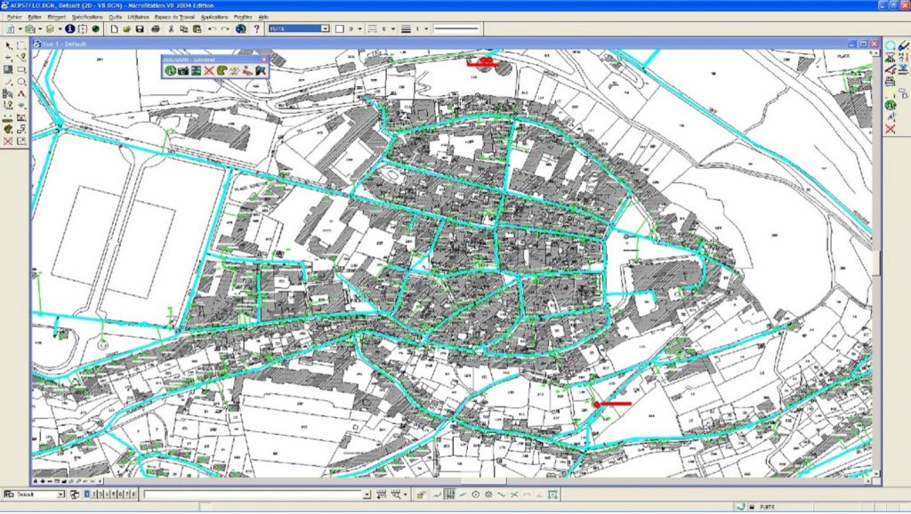
a. Collection and digitisation of plans on SODECI (Société de Distribution d’Eau de Côte d’Ivoire) sites
- Collect the plans of the drinking water distribution networks of the concerned localities from the three Regional Directions of SODECI;
- Scan and digitize the plans collected on site;
- Verify and improve if necessary the legibility of the characteristics and the layout of the pipes and hydraulic equipment of the plan;
b. Constitution of the plan funds by taking over the digital plan funds available from the Directorate of the Cadastre
- Collect from ONEP (Office national de l’Eau Potable) files of plan backgrounds obtained from the Cadastre according to the provisions of the Cadastre – PREMU agreement;
- To calibrate the digitization of the digitized plans of the SODECI on the communicated plan funds;
C. Creation of the digital files of the plans in ESRI SHAPE format of the SIG
- Plan funds
- Parcel of plans
- Public facilities as represented on the plans;
- Roads ;
- Vectorised hydraulic infrastructure with referencing according to SODECI plan data
- Hydraulic works and equipment as represented on the plans (drills, castle, production station, fountain terminal)
- Drinking water canals with their characteristics;
- Hydraulic equipment of the distribution network (winder, drain, valves, etc.)
d. Switching and geo-referencing control
e. It is a question of triangulating information from several data sources, concerning plan funds ( cadastral plans, satellite imagery, etc.). This operation will make it possible to make the plan funds reliable for optimal timing and georeferencing.
f. Realisation of a GEODATABASE (ARCGIS format) for each locality, including the background plan and network (characteristics of the nodes, sections and special parts of the national drinking water distribution network) according to the GIS model that will be transmitted by the ONEP.